New York City's open-data infrastructure has a image problem — literally. Tens of thousands of duplicate photographs are clogging the Department of City Planning's publicly accessible street-level databases, slowing permit reviews and frustrating developers, architects, and community boards trying to make decisions from digital records. The backlog has become especially visible since January 2026, when the city began fast-tracking construction and signage permits ahead of the FIFA World Cup, bringing scrutiny to workflows that had gone largely unexamined for years.
The timing is pointed. With matches scheduled at MetLife Stadium in East Rutherford beginning July 14 and fan zones stretching from Hudson Yards to Flushing Meadows–Corona Park in Queens, city agencies have been under pressure to process streetscape changes at a clip that exposed long-standing inefficiencies. Duplicate images — the same building façade filed multiple times under different permit numbers, or identical street-corner shots uploaded by separate vendors — pile up in ways that require manual review before records can be approved or archived.
What the City Is Actually Doing About It
The Adams administration's Department of Information Technology and Telecommunications, known as DoITT, has been piloting an automated deduplication tool since March 2026 as part of a broader initiative called NYC Open Data Refresh. The program uses hash-matching algorithms to flag visually identical files before they enter the permanent archive. DoITT has not published a completion timeline, but the agency confirmed the pilot is running across datasets maintained by the Department of Buildings and the Department of Transportation.
The practical footprint of the problem is visible in neighborhoods where construction activity has spiked. Along the Jerome Avenue corridor in the Bronx — a stretch the Department of City Planning has flagged as a priority rezoning zone since 2018 — multiple vendors contracted to photograph storefronts for permit documentation submitted overlapping files between 2023 and early 2026, according to public filings reviewed by The Daily New York. In Brooklyn's Gowanus, where Superfund-area redevelopment has accelerated, similar duplication issues slowed at least three environmental-impact reviews last year, based on records submitted to Community Board 6.
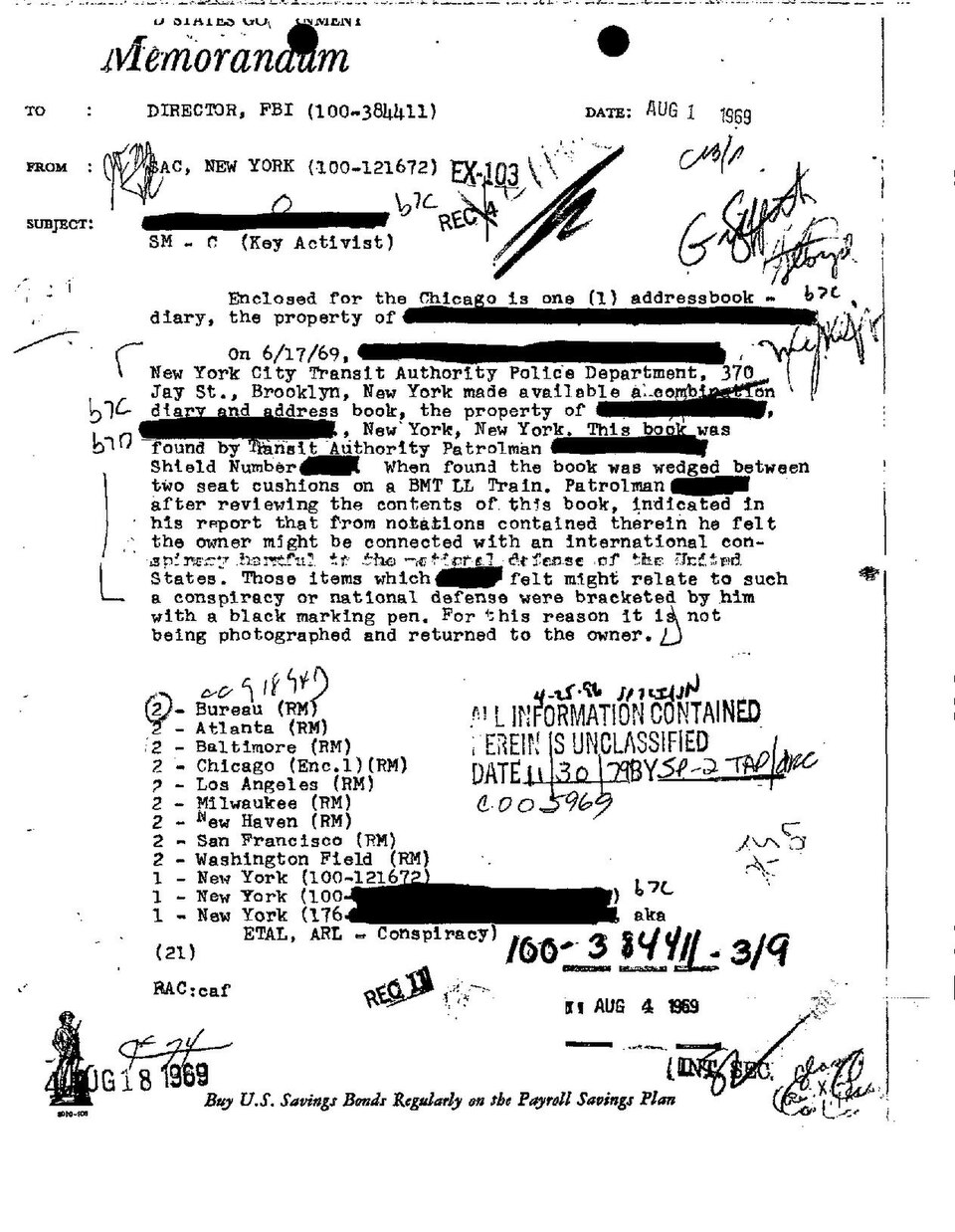
The Metropolitan Transportation Authority faces a parallel version of this challenge. Its capital program, which received a $68.4 billion 2020–2024 commitment, generated station-condition surveys with significant image overlap — particularly at stations undergoing phased renovation, like the 36th Street station in Sunset Park and the Livonia Avenue line in East New York. The MTA's internal asset-management team has been manually reconciling those records since at least 2024.
How London and Tokyo Have Handled the Same Problem
London moved earlier. Transport for London integrated an AI-assisted image-deduplication layer into its asset registry in 2023, tied to the city's overhaul of its street-works permitting system ahead of expanded Ultra Low Emission Zone enforcement. The London approach centralized vendor photo uploads through a single portal with automated duplicate rejection before files enter any review queue — a front-door fix rather than a back-end cleanup.
Tokyo's approach was more structural. Ahead of infrastructure investments tied to the 2021 Olympics — postponed and held that year — the Tokyo Metropolitan Government standardized image metadata requirements for all street-survey contractors in 2020, requiring GPS-embedded timestamps that allowed the city's GIS platform to automatically suppress redundant submissions from the same coordinates within a 90-day window. The result was a leaner archive that city planners cited as a model in a 2022 international urban-data conference held in Singapore.
New York's current pilot gets partway there, but it operates downstream — catching duplicates after upload rather than blocking them at submission. That distinction matters: the city's construction permit volume has climbed, and DoITT's deduplication queue is processing a growing backlog rather than preventing one from forming.
For residents, developers, and community boards navigating the NYC Department of Buildings portal at 280 Broadway, the practical advice is straightforward: if a streetscape image submission is returned for review, check whether a nearly identical file already exists in the system under a related address or permit number. Cross-referencing the city's BIS portal before submission can cut processing delays by days. DoITT's Open Data team has published updated vendor guidelines on NYC.gov as of June 2026, and compliance with those specs is now a condition of vendor contract renewal.